
- Brief Us
- info@upsteer.com
- Tel. (+91) 040 3516 2499 (India) or (+1) 416 684 5726 (Canada)
- Head Corporate Office (India)
- Plot No 70 A/B, First Floor, Aziz Manzil, LNS Road, MLA Colony, Road No 12, Banjara Hills, Hyderabad, Telangana, India - 500034
- Corporate Office (Canada)
- 4060 Channing Crescent, Oakville, Ontario, Canada - L6H 3R2
Drones, or unmanned aerial vehicles (UAV), are a rising trend among many industries. Today, the impact of drone technology on the digital transformation of multiple industries are undeniable.
Our solutions span from 3D mapping and surveying of land all the way through progress monitoring to inspection. Spanning a wide range of industries. You can depend on us for the highest accuracy and high reliability results as Upsteer is one of the leading drone solutions provider in the industry.

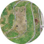
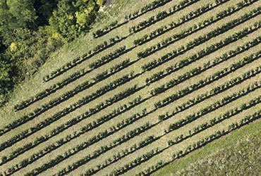
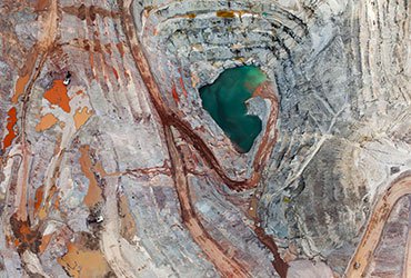
Drone Surveys and Mapping
FASTER AND MORE ACCURATE RESULTSObtain data much faster than traditional survey methods, with higher accuracy and granularity. This provides a more cost effective way of carrying out land surveys and a data accuracy of 3cm.
- Orthomosaic
- 3D Map
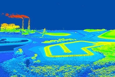
- Point Clouds
- Contour Map
- Distance & Volumetric
- RGB, Thermal & Multispectral
All of the data provided is compatible with existing GIS software and our highly trained team know exactly how to support you in using this data effectively.

Progress Monitoring
KEEP PROJECTS ON SCHEDULE & WITHIN BUDGETAccurately track your project's progress, manage resources more effectively, and reduce downtime. This means you can keep projects on schedule and within budget. It also mitigates risk.
- Easy calculation of distance, perimeter or volume
- Monitor construction progress regularly
- Reduce risk and accidents
- Easily mitigate risk and manage the sites
- Better track a project’s progress, manage resources, reduce downtime, and keep projects on schedule and within budget
- Images can be used to record progress, for management reporting or for marketing purposes.

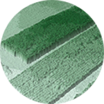
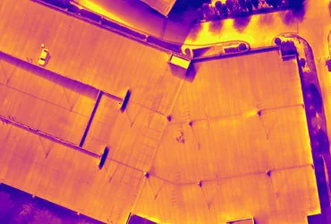
Drone Inspections
QUICKLY OBTAIN DATA FROM HARD TO REACH PLACESObtain high resolution images and video of critical infrastructure on a regular basis. More regular inspections, lower cost & faster turn-around than employing inspectors.
Obtain high resolution images and video of critical infrastructure on a regular basis. The use of Drone Technology enables us to provide more regular inspections at a much lower cost base and much faster turn-around time than employing specialists to carry out the inspection work manually.
Our data is provided in:
- Zoom
- RGB
- Thermal
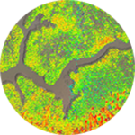
The data collected by sensors generates orthomosaics, 3D models, point clouds and digital surface models. When used alongside survey grade GPS systems - sensor images can be stitched together producing one accurate geo-referenced image that is viewable in both 2D and 3D.
Orthomosaic
3D Model

Point Cloud
Digital Surface
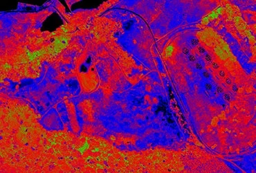
The industry applications for drone-based sensors are limitless. Sensors can identify plant disease, assess water quality, secure volume measurements, detect heat signatures and produce surface composition surveys, and more. Sensors easily connect with compatible drones and can be swapped out to support a diverse set of enterprise needs.
Visual
Capture high-resolution, low distortion aerial imagery.
Video
Capture and live stream high definition video to multiple devices on the ground.
Terminal
Track the relative surface temperature of land and objects.
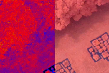
Multispectral
Capture near-infrared radiation and ultraviolet light invisible to the human eye.
Hyperspectral
Capture spectral information to identify minerals, vegetation and other materials.
Lidar
Collect high quality, accurate elevation data of natural and man-made objects.
Drone technology is rapidly moving into the commercial sector with multiple industries recognising the limitless potential drones can bring to their operation.

Team
India's leading team of UAV specialists. What they don't know isn’t worth knowing.
Tools
The tools must meet the brief. We carry the world’s leading brands and align these to application solutions.

Training
Tools and solutions are of little value without operating skills. We provide tailored training for solution certainty.